Wednesday, June 15, 2016

B.C. Geocaching Road Trip - Part 2


The long awaited part 2 of the write up of our late summer geocaching road trip to Merritt - Kamloops - Vernon.

Click on any of the pictures to see the full size version

Day 3 we awoke in Kamloops and cached in the city for a while as we picked off a few in the south part of the city near our hotel. Eventually we headed north towards the Thompson River area and then east as we followed the river out of town towards our next destination of Vernon.

We have cached several time sin Kamloops and I have many photos and enough video already so I opted to not repeat material from past posts and instead will pick up the storytelling in Westwold.


Westwold is a small community on Highway 97 as you run south from Kamloops down to Vernon.
Our first memorable geocache was located at a business named Wildrides Hotrods. It is a combination garage/car servicing and restoration business, as well as having some old cars and trucks out front to entice folks to stop by for a view and a bite to eat from the small cafe the have on site.


We got to have a look around at the old cars and find a cache at the same time, not a bad two for one stop on the road.

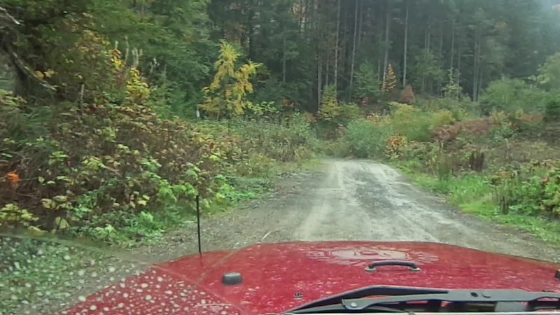
We cached our way steadily south through small communities with the highlight of Falkland being the "big" city on this highway. I had planned a route that was heavy in Kamloops and lighter on the road so we could make time as we headed to Vernon to visit another brother and his wife As the day wore on we realized that we had to stop caching and start making time if we were to keep our "dinner" date with Wayne and Inga so we put aside the GPS and put the pedal down so we could spend some time visiting family.


Day 4 and the last day of the road trip we spent the morning caching in urban Vernon enjoying the downtown core on an early Sunday morning before the crowds woke up.
This gave us the opportunity to see some of the murals in the core area representing the history of Vernon. Transportation seemed to be the theme with multiple murals depicting some sort of travel method.


Seems like where ever you are in Vernon you are not far from a lake...whether it be Okanagan Lake or Woods Lake or Kalamalka Lake one of them is always in your view.

As we headed south out of Vernon back down towards home on the Coast we opted to take the scenic route and cached along a back road named Commonage Road that straddled the high ground between the big waters of Okanagan Lake and some of the smaller lakes.


Here you see a good division of work between brothers...sorta like the well oiled caching machine we are. MrTJ works on some potato chips, tjguy98 runs the video camera, and Bowser98 does the work of finding the cache and signing the log book. Works like a charm!  :)

  
Further south you are back on the shores of Okanagan Lake in aptly named
"Lake Country". This is one of those areas where every driveway has a boat and/or seadoos to go with it. A truck to tow the boat is the typical family wheels, no travel trailers or RVs to be seen here.


Lake views and cool breezes from the lakes are the normal experience when you are in Lake Country. We were a bit late in the year for the crowds but a few die hards were still out enjoying the last days of an Indian Summer before they had to put the boats away for the winter.


Into Kelowna we sailed picking up a roadside cache here and there as we continued our return trip home. One of the caches we stopped for was in West Bank at Paynter's Fruit Market where a local farming enterprise had a large market-type operation that was obviously well appreciated by the local residents. Many types of fruit and vegetables were sold outside  and inside many locally produced food items were available...tempting enough that we grabbed a few items off the shelf for the long lonely drive home.


But I digress...we were here on a mission to find a geocache and the old tractor on display made a convenient location to place a magnetic cache box hidden from muggles but a quick find for cachers.

On our last leg of our journey we headed along the Coquihalla Connector, which joins West Bank to Merritt, picking up new caches since our last run down the highway. We were now in "make-up-time" mode as we grabbed a few caches right off the on ramps/off ramps of the highway never straying far from the main thorough fare.


The last three caches were all along the same short spur road, which was actually part of the old Highway 5A. A yellow middle line on the pavement and an old brake check sign told us we were standing on an outdated piece of motor car history.

The very last cache we found was jsut east of Merritt on the long downhill stretch into Merritt . Some joker has left an old toilet as if they came here to use the open air facilities while enjoying a magnificent view of the Nicola Valley with Merritt as it's centre piece.

This was also the place where, after 4 days of crashing through bush and scrambling up and down hill sides, MrTJ decided to gash his leg open on the old potty...ewwwww....

Watch the video and you will see that MrTJ, trooper that he is, found the cache first and then tended to the gash on his leg. Bowser98 and myself  had the same geocaching dedication so we signed the log book and then tucked the cache back away in it's hiding place before we went back to the truck to render first aid to MrTJ.


This was the last cache of the day, the last cache of the 4 day road trip through the Interior of BC, and my very last video shot of the trip.
The sun came out from under a dark cloud and bathed Merritt in a blast of sunlight. The scene was so pretty I expected to hear angels singing.

I realized the video shoot was something I couldn't top so I put the camera away and we jumped into the truck to make a run for the Coast and back to our home sweet homes.

Four days on the road netted us 160 caches, a visit with a brother and his wife, and a load of new memories for the memory banks. A pretty satisfying road trip for the Jeep Brothers once again.

Watch the video below by clicking on it or by visiting my YouTube page here.


Monday, February 08, 2016

B.C. Geocaching Road Trip - Part 1


As the year wound down myself and brother Al and brother Ken did our yearly geocaching road trip to the Interior of the BC province. We usually head up through Merritt, Kamloops, loop over to Vernon, and then decide which route to take home depending on how many days we are away and where we end up on the second to last day of the trip. This year we more or less stuck to tradition and did the route described above. One of the good thing about looping through Vernon is then we get to visit one of our other brothers Wayne and his wife Inga.

The first day we cached our way from Maple Ridge up through the Coquihalla Highway famed for the TV show "Highway Through Hell" so named as the winter pass received huge amounts of snow making this main provincial artery one of the hardest and most dangerous roads to travel. We were travelling in early Autumn so the weather was good but high volumes, high speed, and wild life combine to make this highway dangerous any time of the year


We got off and on at various exits along the highway as we picked up caches in tucked away spots with sign markers that highlighted this main route of today and yesteryear. From cattle drives before the railway to the coming of the mountain railway itself this route through the mountains was full of history.


One of the geocaches had us scrambling up the side of a loose shale hillside to get to the top of a bluff where the geocache was hidden. While the two brothers risked their life slipping and sliding up the hillside (can't wait till they come down) I stayed below and recorded it all on video in case something terrible happened and I should need to post the video to YouTube.I immediately realized I had the wrong attitude about them hurting themselves up there.....here I was down on level ground, there they were up in a dangerous spot and I thought to myself.....those buggers have both the keys to the truck!


A few more caches along the way and soon enough we were in the big town of Merritt. We checked in at the motel to confirm our room for the night, then headed off to cache around the city for the rest of the day. We cached for a few more hours into the dark and then headed off to the local Tim Hortons for a late lunch/dinner combined before we meandered back to the hotel for the night.

DAY 1 - 12 caches and a couple of hundred miles under our belts...


.Day 2 had us up early and finishing off the local caches in Merritt before we headed north-east out of town. The first cache was only a couple of blocks away from our hotel - it was close enough that MrTJ was still eating his breakfast banana as Bowser98 and myself found the cache just a ways in from the road. Banana finished and the rest of the local caches found, we headed out of town along Highway 5A into the the north end of the Nicola Valley and alongside Nicola Lake.


We approached the southern end of Nicola Lake where it the lake ends in a marshy drainage area that is a home for a myriad of water fowl. Many species of birds overwinter here - in the past I have seen huge rafts of various types of birds from American Coots to Common Mergansers and everything in between. As it was still only September and Winter was not any where near yet, summer songbirds like the Red Winged Blackbird could be heard singing their daily songs.


We picked up caches along the east side of Nicola Lake as we slowly sauntered north towards our goal of Kamloops for the night. Along the way we were reminded that this is Cowboy country and not that long ago in the scheme of things wagon trains and stagecoaches were the transportation choices rather than cars with rubber wheels.


The Quilchena Hotel built in 1908 in the small settlement of Quilchena replaced an earlier hotel that was not up to the standards of Joseph Guichon when he purchased the property. The Guichon name is synonymous with the "history" of the region and you will find the Guichon name in many historical and present day contexts.


One of the geocaches we found,located in the hills above the Quilchena Hotel and ranch land, was part of the Gold Rush series of caches hosted by the a number of towns in this area of the province. They were designed to highlight the history of the various regions and at the same time act as a centre piece to attract tourism to the towns whose local economies have suffered as the logging and resource industries have died down. This has been a very successful campaign over the years and I know of many geocachers whom have spent their holidays in the area. Including us!  :)


We eventually left the Nicola Lake area as we continued north along Hwy 5A coming across numerous lakes situated in a north-south axis where Ice Age glaciers had carved grooves in the land. Stump Lake is one of the bigger lakes in the area and like most of the lakes had a major ranch operation on it's banks. The Stump Lake Cattle Ranh was established in 1883 and today boasts of 80,00 acres of land which ranges from rolling grasslands to evergreen and deciduous forests to lakes, wetland marshes, and high rocky bluffs.


As we were getting close to Kamloops we decided to take off onto one of the numerous ranch roads in the area to take the slow way into the big city and at the same time let us slow down and see more of the ranch life. Campbell Creek Road has a series of 25 or so caches along it's length and would drop us out on the east side of Kamloops.


So, what we would you expect to see along a road that cuts through ranch land? Why, cows of course...and we seen a lot of them along this road. The road itself was dirt but well traveled so that even cars were common along here. Not that we seen a lot of traffic...we did see a lot of cows....I think I mentioned that....there were a lot of cows.....

 .
One of my favourite things to explore is backroads and this road fit right into what I love to explore.But like all goods things, soon enough we were at the end of Campbell Creek Road and back into civilization.
We hunted up a few more caches in the outskirts of Kamloops and then headed into town to claim our hotel room,grab a bite to eat, and then finish the night off with a half dozen caches done in the dark.

DAY Two over - another hundred or so miles and 63 more geocaches found on the day.

End of Part 1 - watch for Part 2 to come soon.....watch the video below covering Day One and Day Two....


Friday, January 29, 2016

Harrison Lake West - Puttering About

Another Sunday came and I scored another "free" day for me to wander about aimlessly in my extended backyard.

Today I opted to go a few miles up the West Harrison Lake Forest Service Road (FSR) to get a few pictures of the lake and do a wee bit of geocaching while I was at it.

Click on any picture to see the set in full panorama view  :)

First stop was at at lookout high above Harrison Lake, last stop was the back roads around Lake Errock.

The West Harrison Lake FSR is a familiar friend and I have been up this way many times over the years. A few years ago I put a series of geocaches along here that is best accessed via 4X4 as the first of the caches is 20 miles up the FSR. Steep rutted hills, sever washboard, and sharp gravel makes these caches not the ideal choice to go for in the family grocery-getter.

As I was only headed as far as mile 4 there was no rush to get there, or anywhere, so I puttered along content to check out small little goat trails off the main road that led to 2-3 truck camping spots or dead ended a couple of hundred feet off the FSR.


I took one of the main turn offs that gave a commanding few of the south end of Harrison Lake and snapped off a few pictures. Low hanging clouds associated with rain showers meant the lake was partly obscured for the camera but I could see just fine.The lake is 60 kms long so although I could see up and down the lake in reality I could only see a small portion of the lake.


This is one of my favourite pictures...I think it's due to the ribbon of brown sandwiched between greens and browns of the foliage with the vast blue and whites of vast lake in the background.

MAH01327

Proving that any age is a good age to splash in puddles, I decided to try out the video setting on my camera to see how it works. To do that I needed any "action" shot, and since the Jeep was still way too clean, I thought I could make everyone happy (me and the Jeep) at the same time.


There, that looks a lot better! Now all the other Jeep owners won't laugh at me and not let me play their stupid reindeer games!


Back down at the start of the forest service road is Weaver Creek Spawning Channels created by Fisheries Canada and now run by the local Sto:lo First Nations people.
The channels provide a natural habitat for the various types of salmon returning to spawn, the most prized being the Sockeye salmon.


Today it was mostly Chums in the hatchery beds but the limited numbers was enough to provide interest for the tourists.


The few Sockeye that were here stood out in stark relief to the mottled grayness of the Chum.


There is plenty of room in the man made beds but one thing is for sure - all the salmon end up as food for the wildlife. Bears, raccoons, seagulls, and every other form of fur and fowl have a field day gorging on the plentiful bounty of the salmon runs.


It's no surprise that such a great supply of food during the winter salmon runs would attract Bald Eagles to the area.The large predators enjoy a a tightly packed area of rivers full of spawning salmon. Weaver Creek, Chehalis River, Harrison River, Fraser River, and many side channels and marshes of the Harrison River and the Fraser River supply enough salmon to make this area one of the top 3 wintering areas of the Bald Eagle on the Western Flyway. The Squamish River area is usually #1 spot, Haynes Alaska is #2, and the Chehalis Flats area of the Harrison River is #3.
A tourist industry has sprung up surrounding the December-January return of the eagles. Squamish has done this for years but in the past 3-4 years this part of the larger Fraser Valley has gotten organised and promotes various marketing campaigns to bring the Metro Vancouverites to the area.


Remnants of a former age are scattered throughout the local forests...some of the biggest stumps of Red Wood Cedars and Douglas Firs I have seen are in a local suburban Surrey park. I spotted this one a mile or so up the Chehalis FSR as there were two geocaches I wanted to nab. The notch you see in the tree stump was chopped there by loggers to insert a springboard. A Spring board was a long plank of wood with a pointed end they would insert into the notch they cut into the tree. The trees of yesteryear were first growth trees,and often stood a couple of hundred feet tall. The bases of the trees were massive and would take forever to chop three either with an axe or with a two man whip saw. The loggers "cheated" a little bit by starting the cut 10' feet up the tree were the tree trunk was thinner.


There are numerous artesian wells in the area some of which are on private property. In this case, the local land owner was tired of people trespassing on his land to fill their water jugs and making a mess of the forest undergrowth so he tapped into the well and ran a line down the hill to the forest road for the public to access the water there. To make it a bit interesting he built a small rock wall and put a statue of Buddha to offer good vibes in the area. There is an Earth geocache here (Earth cache means there is no actual cache, just a "virtual" to discover the area, and another actual cache across the road along a the banks of a small creek. In the old days you would call that a "two-fer"  :)


On the list of my "must sees" when ever I bring someone new to the area is the old Kilby Museum in Harrison Mills. Originally a train stop it became a small community onto it's own as the local loggers from the logging "shows" or forest operations, needed a place to stay so the train stop became a combination general store below and a small boarding house on the upper floor. It was also a distribution point for the farmers in Chilliwack across the Fraser River who would row across the river with their fruits and vegetables to catch the 4.00 PM train to take their produce into the vast market of Metro Vancouver.

Later with the rise of the auto-mobile gas pumps were added to service the area. OK, so your first question is...."why is there a board walk going up to the second floor"?

This area was prone to springtime flooding and it was quite common for the surrounding land to be under 6 feet of water for a few weeks. The basement of the store, which was actually ground level, was just bare dirt and other than a few tools and work benches was left empty as it was often under water with the freshet.

I sauntered out of the Harrison Mills, rambled east down the Lougheed Highway, and meandered into the back roads of Lake Errock. Lake Errock is actually an old oxbow of the Harrison River situated slightly upstream of where it empties into the Fraser River. Looking at a topo map it's easy to see that this oxbow was probably part of the Fraser River at one time before the river cut itself off and left the Harrison River to claim this twixt of water.


Here was one of the neat things about aimlessly driving down back roads...you find the most interesting things. I knew that the Western Painted Turtle is on the endangered species list in BC. I have even seen them in some suburban parks sunning themselves on logs...I did not know there was a small population in a marshy area in the Fraser Valley. I have to chalk up this find to geocaching as there was a couple of nearby caches that highlighted this turtle oasis; without the impetus to drive down this stretch of road I might not have found this reserve.


All kinds of treasures are found are found down back roads...some are a wonder of nature, some are a small feat of modern man. In this case an old Fargo pickup truck trying to maintain it's dignity sat in a corner of someones rural property...all but abandoned and being overtaken by brambles. I can't help but think this is a diamond just waiting for the right person to find it and restore the truck to it's former glory.


Now this is what back road exploring is all about....a beauty of nature in the form of two large firs growing out of the same trunk tucked right against the edge of the road and the local community having the grace to leave the tree as is and have the road skirt the edge of the tree. This quaint image is one that I think of when I think of what I would like to see when I am Out and About rambling the back roads of Beautiful British Columbia.

The full album of today's pictures can be seen on my Flickr web page here.


Wednesday, January 27, 2016

Fort Hope Is Where It's At


Late October I had a "free" Sunday...one of those days where there is no shopping to do, no running around, no "things" to pick up, nada...even Annette was content to pick up a book and give it some serious attention.
I thought that was a great idea as well, until I heard the Jeep in the garage crying a little bit as it wanted to go out and play. Being a good pet owner, I told Annette I was off for the day, and grabbed the keys and headed to the garage. Annette called out "where you going"? I said "Out and About"....
Well, actually I did tell here where  I was heading to just in case I didn't come back on time and she needed to send out a search party

Click on the pictures to see them full size to get the full magic effect of them !  :)

I took a few minutes at my computer to figure out where I wanted to head....my playground extends from the Shores of the Pacific Ocean on the west, to Squamish in the North, and as far as east to Hope BC. I consider that large region my "backyard"...and a fine day tripping region it is.

I thought I might head either up the Coquihalla Canyon or up the Fraser Canyon..both of them I love to putter around in discovering new niches that I haven't come across yet. I made note of a few geocaches in the Hope area and a few new ones up each route, as well as a few coming back west along the Lougheed Hwy from Hope. Armed with a few geocaches, a full tank of gas and a camera I headed off to the far corner of my backyard...Hope BC.

Hope, or Fort Hope, as it it started life as a Hudson Bay Trading Company fort in 1848; well before that the local Sto:lo First nations had a settlement here stretching back 10,000 years.

Hope is 96 miles east of Vancouver, it is the head of the massive Fraser Valley that runs from Hope all the way to the sea. It's also a cross roads where three highways diverge to take you to points farther into the heart of BC.

To the north Highway #1, the Trans Canada Hwy, takes you up the amazing Fraser Canyon and points north and, if you choose, east towards Kamloops.

Northeast takes you along the astounding Coquihalla Hwy through mountain passes affectionately known to BC'ers as the "Coke" and known to TV viewers as "The Highway Through Hell" as winters are particularly brutal through the high passes.

East takes you along one of the original routes in Southern BC. Hwy #3 follows the old Dewdney Trail first blazed in 1861 as a rough trail designed to keep the gold in BC rather than having miners take the existing southerly routes like the Skagit River Trail into the U.S.

Hwy #3, also known as The Crowsnest Pass is the gentlest of the routes but even this highway has teeth that bite the uninitiated.

So, here I was at Hope...deciding which way the wind blew.....eventually I figured out the wind wasn't blowing at all and I settled down and decided to roam the back alleys and side streets of this small town where major rivers meet and major highways joined into one to allow travellers in a hurry to race to the big city of Vancouver.

        
I changed my mindset, put away the GPS, and took out my camera and started prowling around the outer edges of Hope looking for some good shots. I meandered over to the mouth of the Coquihalla River where it empties into the Fraser River. I knew there was a local park with river access, I thought this would be a good place for some pictures of the wide Coquihalla River. As you can see from the picture above, the river was running low as the winter rains had not started, and the summer melt of snow had not yet been replaced in the mountains to feed the river.


What I found instead was a vast expanse of gravel bed with the river far off nudged against a bluff. Well, that was not what I expected but still made for a good picture..


The old bridge on Hwy #1 over the Fraser River has been the scene of many accidents as it has a sharp bend at the eastern end. Many semis have failed to negotiate this turn on their night runs down the Fraser Canyon. With downhill momentum on their side and "speed" on the driver's brain they remember too late that the turn is almost 90 degrees and 60 miles an hour in a loaded semi spells bad news.


Art can be found almost anywhere, every common day object has it's beauty...the old highway bridge was no different. Standing at the gated underside of the bridge, I shot through the wire mesh gate and zoomed in a little to get the fade away box effect...it reminded me of a "metal tramway to infinity".


As if to re-enforce it's place in the history of Hope a historical sign board tucked away along a rural road proclaims the importance the Hudson's Bay by highlighting one of the original Fur Brigade Trails from the Interior to the Coast. A "fur brigade" consisted of 20 men and 200 horses packed with furs of fox, beaver, bear, mink, and other animals trapped in the lush Interior of BC. All furs were bound for either Fort Hope or Fort Langley to board trading ships to Hawaii or home to England.


A small lake is nestled between the town and the start of the mountains at the eastern edge of town. It is a local hot spot during the summer for the residents...it provides a respite of cool on hot summer days.


Serene and quiet on an Autumn day....you would never know that this little lake is a hub of activity on warmer days.


Hope found fame again a few years back when a large tree fell in the city centre and rather than just cut it up and haul it away a local artist asked if he could use his chainsaw and create a piece of art. Well, what kind of art can you create with a wild chainsaw? Apparently some pretty fantastic pieces....today more than 20 of Pete Ryan's creations stand around town providing highlights of an interesting walking tour of the city.

The carving of the dog is dedicated to the RCMP Police Service Dog Chip who was shot as he and his handler pursued a suspect in the mountains just outside of Hope.

I poked around Hope a little more until I was back onto familiar ground that I knew well, so I decided it was time to find some new land and picked up Hwy #7 the Lougheed Hwy as it ran west back towards Vancouver.

I took out my GPS and fired it up, as I knew there were a few geocaches down side roads I had not yet been along. Another reason why I love geocaching - it goes hand-in-hand with that sense of exploration that I have.


The hunt for caches led me to a backwater slough of the Fraser River I hadn't discovered before, and it also took me down a rural back road that I had not been on for 20 years. It was still as pretty as I remember it...


Being in the open farm lands provided good views of the ring of mountains that come together near Hope to form the eastern end of the Fraser Valley and the start of the Coast and Cascade Mountain Ranges. Click on the pictures to zoom in and look at the logging road clinging to the side of the mountain...only loggers, goats, and deer would dare go up there. And, oh yeah, guys with Jeeps...yeah I'm one of those guys, I've been on that mountain shelf road a few times. Awesome views from up there!


I went a short ways up the western flank of Mt Wooodside east of Agassiz to a lower level lookout that provided a scenic view. The top picture is looking south-west towards Chilliwack; the bottom picture is looking west towards Abbotsford in the far, far, distance.

Here is an "Eddie Favourite Fun Fact".... look at the bottom picture...the hills you see in the near right and the far left are actually mountain tops. As the massive glaciers covering North America started melting 10,000 years ago the Fraser River carried the glacial till in it's belly until the river slowed down in the flats of the valley and the sediment dropped out. The river sediment here is over a mile deep making the Fraser Valley one of the richest farming areas in BC.

Here is another "Eddie Favourite Fun Fact"... as the glaciers melted, the Ice Age Fraser River was massive - the mountains on the North Shore of Vancouver formed the northern edge of the river delta....the mountains to the south of Bellingham Washington was the southern delta edge. That is 112 kms wide....the present day Fraser River delta is split over three arms of the river, the widest arm only slightly more than 500 meters wide.

 
I ended my day with a quick grab of a geocache in this old road warrior advertising the local stock race track. The bright yellow of the car and squareness of the white sign board stood out like sore thumbs against the backdrop of flat drab farm land in it's winter coat.

I put away the camera, turned off the GPS, stashed my papers and notes on the passenger seat as I turned the iconic 7 slot grill of the Jeep towards home now just a half hour away.

I covered 200 miles in 6 hours, fired off over 100 shots on the camera in my wanders, found some wonderful scenery I had not seen before, and came home with a smile on my face and a feeling of contentment in my heart......not a bad way to spend a "free" Sunday.

The best 35 of the lot of pictures can be found on my Flickr web site here