Late October I had a "free" Sunday...one of those days where there is no shopping to do, no running around, no "things" to pick up, nada...even Annette was content to pick up a book and give it some serious attention.
I thought that was a great idea as well, until I heard the Jeep in the garage crying a little bit as it wanted to go out and play. Being a good pet owner, I told Annette I was off for the day, and grabbed the keys and headed to the garage. Annette called out "where you going"? I said "Out and About"....
Well, actually I did tell here where I was heading to just in case I didn't come back on time and she needed to send out a search party
Click on the pictures to see them full size to get the full magic effect of them ! :)
I took a few minutes at my computer to figure out where I wanted to head....my playground extends from the Shores of the Pacific Ocean on the west, to Squamish in the North, and as far as east to Hope BC. I consider that large region my "backyard"...and a fine day tripping region it is.
I thought I might head either up the Coquihalla Canyon or up the Fraser Canyon..both of them I love to putter around in discovering new niches that I haven't come across yet. I made note of a few geocaches in the Hope area and a few new ones up each route, as well as a few coming back west along the Lougheed Hwy from Hope. Armed with a few geocaches, a full tank of gas and a camera I headed off to the far corner of my backyard...Hope BC.
Hope, or Fort Hope, as it it started life as a Hudson Bay Trading Company fort in 1848; well before that the local Sto:lo First nations had a settlement here stretching back 10,000 years.
Hope is 96 miles east of Vancouver, it is the head of the massive Fraser Valley that runs from Hope all the way to the sea. It's also a cross roads where three highways diverge to take you to points farther into the heart of BC.
To the north Highway #1, the Trans Canada Hwy, takes you up the amazing Fraser Canyon and points north and, if you choose, east towards Kamloops.
Northeast takes you along the astounding Coquihalla Hwy through mountain passes affectionately known to BC'ers as the "Coke" and known to TV viewers as "The Highway Through Hell" as winters are particularly brutal through the high passes.
East takes you along one of the original routes in Southern BC. Hwy #3 follows the old Dewdney Trail first blazed in 1861 as a rough trail designed to keep the gold in BC rather than having miners take the existing southerly routes like the Skagit River Trail into the U.S.
Hwy #3, also known as The Crowsnest Pass is the gentlest of the routes but even this highway has teeth that bite the uninitiated.
So, here I was at Hope...deciding which way the wind blew.....eventually I figured out the wind wasn't blowing at all and I settled down and decided to roam the back alleys and side streets of this small town where major rivers meet and major highways joined into one to allow travellers in a hurry to race to the big city of Vancouver.
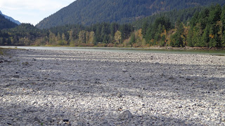
I changed my mindset, put away the GPS, and took out my camera and started prowling around the outer edges of Hope looking for some good shots. I meandered over to the mouth of the Coquihalla River where it empties into the Fraser River. I knew there was a local park with river access, I thought this would be a good place for some pictures of the wide Coquihalla River. As you can see from the picture above, the river was running low as the winter rains had not started, and the summer melt of snow had not yet been replaced in the mountains to feed the river.
What I found instead was a vast expanse of gravel bed with the river far off nudged against a bluff. Well, that was not what I expected but still made for a good picture..
The old bridge on Hwy #1 over the Fraser River has been the scene of many accidents as it has a sharp bend at the eastern end. Many semis have failed to negotiate this turn on their night runs down the Fraser Canyon. With downhill momentum on their side and "speed" on the driver's brain they remember too late that the turn is almost 90 degrees and 60 miles an hour in a loaded semi spells bad news.
Art can be found almost anywhere, every common day object has it's beauty...the old highway bridge was no different. Standing at the gated underside of the bridge, I shot through the wire mesh gate and zoomed in a little to get the fade away box effect...it reminded me of a "metal tramway to infinity".
As if to re-enforce it's place in the history of Hope a historical sign board tucked away along a rural road proclaims the importance the Hudson's Bay by highlighting one of the original Fur Brigade Trails from the Interior to the Coast. A "fur brigade" consisted of 20 men and 200 horses packed with furs of fox, beaver, bear, mink, and other animals trapped in the lush Interior of BC. All furs were bound for either Fort Hope or Fort Langley to board trading ships to Hawaii or home to England.
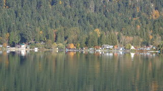
A small lake is nestled between the town and the start of the mountains at the eastern edge of town. It is a local hot spot during the summer for the residents...it provides a respite of cool on hot summer days.
Serene and quiet on an Autumn day....you would never know that this little lake is a hub of activity on warmer days.
Hope found fame again a few years back when a large tree fell in the city centre and rather than just cut it up and haul it away a local artist asked if he could use his chainsaw and create a piece of art. Well, what kind of art can you create with a wild chainsaw? Apparently some pretty fantastic pieces....today more than 20 of Pete Ryan's creations stand around town providing highlights of an interesting walking tour of the city.
The carving of the dog is dedicated to the RCMP Police Service Dog Chip who was shot as he and his handler pursued a suspect in the mountains just outside of Hope.
I poked around Hope a little more until I was back onto familiar ground that I knew well, so I decided it was time to find some new land and picked up Hwy #7 the Lougheed Hwy as it ran west back towards Vancouver.
I took out my GPS and fired it up, as I knew there were a few geocaches down side roads I had not yet been along. Another reason why I love geocaching - it goes hand-in-hand with that sense of exploration that I have.
The hunt for caches led me to a backwater slough of the Fraser River I hadn't discovered before, and it also took me down a rural back road that I had not been on for 20 years. It was still as pretty as I remember it...
Being in the open farm lands provided good views of the ring of mountains that come together near Hope to form the eastern end of the Fraser Valley and the start of the Coast and Cascade Mountain Ranges. Click on the pictures to zoom in and look at the logging road clinging to the side of the mountain...only loggers, goats, and deer would dare go up there. And, oh yeah, guys with Jeeps...yeah I'm one of those guys, I've been on that mountain shelf road a few times. Awesome views from up there!
I went a short ways up the western flank of Mt Wooodside east of Agassiz to a lower level lookout that provided a scenic view. The top picture is looking south-west towards Chilliwack; the bottom picture is looking west towards Abbotsford in the far, far, distance.
Here is an "Eddie Favourite Fun Fact".... look at the bottom picture...the hills you see in the near right and the far left are actually mountain tops. As the massive glaciers covering North America started melting 10,000 years ago the Fraser River carried the glacial till in it's belly until the river slowed down in the flats of the valley and the sediment dropped out. The river sediment here is over a mile deep making the Fraser Valley one of the richest farming areas in BC.
Here is another "Eddie Favourite Fun Fact"... as the glaciers melted, the Ice Age Fraser River was massive - the mountains on the North Shore of Vancouver formed the northern edge of the river delta....the mountains to the south of Bellingham Washington was the southern delta edge. That is 112 kms wide....the present day Fraser River delta is split over three arms of the river, the widest arm only slightly more than 500 meters wide.
I ended my day with a quick grab of a geocache in this old road warrior advertising the local stock race track. The bright yellow of the car and squareness of the white sign board stood out like sore thumbs against the backdrop of flat drab farm land in it's winter coat.
I put away the camera, turned off the GPS, stashed my papers and notes on the passenger seat as I turned the iconic 7 slot grill of the Jeep towards home now just a half hour away.
I covered 200 miles in 6 hours, fired off over 100 shots on the camera in my wanders, found some wonderful scenery I had not seen before, and came home with a smile on my face and a feeling of contentment in my heart......not a bad way to spend a "free" Sunday.
The best 35 of the lot of pictures can be found on my Flickr web site here


3 comments:
Awesome…. It really nice.. Like Northern Toronto
Nice pics! Thanks for sharing!
Who would be crazy enough to drive up there? Well, err...ah...nobody I know!
Pics of the carved wooden figures in Hope reminded me of a wonderful day we spent with you folks a few years ago. And I loved the old Chevy pickup with the pumpkins.
Post a Comment