Showing posts with label Fraser Valley. Show all posts

Thursday, August 01, 2024

 Cruising into the Columbia Valley


ALL PICTURES ON THE DAY CAN BE FOUND ON MY FLICKR WEB SITE HERE

YOU CAN ALSO CLICK ON THE PICTURES YOU SEE ON THIS PAGE TO HAVE THEM OPEN FULL SIZE

Recently Brother Ken, aka MrTJ in geocaching circles, and myself decided to make a foray into a forgotten corner of the Fraser Valley, someplace where neither of us have visited for 50+ years.

Cultis Lake, 60 miles east of Vancouver, B.C. is Vancouver's local favourite summer time destination. Cultis Lake is a fair size lake surrounded by long time summer cottages on the east, new lake front houses on the north, and densified during the summer by multiple campsites both in Cultis Lake Provincial Park and private campsites along the south shore. At the west end of the lake is the small village of Lindell Beach, an old clutch of summer cabins turned mixture of permanent residences and long time family cottages.

Beyond Lindell Beach, west along Columbia Valley Road, lays a large valley mostly forgotten about by the summer visitors. The craziness of the boaters, paddlers, swimmers, campers, and the occasional obligatory moron, is quickly left behind in just a few minutes as Columbia Valley Road ascends a small bluff and emerges into the Columbia Valley. Due to glacial action thousands of years ago, the Valley is officially classified as a "hanging valley."

The first impression you receive is that you could be in any rural green valley near Salmon Arm, or anywhere in the central part of Vancouver Island. The look of the valley belies its nearness to Canada's third largest city. 

Ken and I barely remember the valley from those many years ago, safe to say neither of us remembered it as we seen it this day. There were a few newer hobby farms with big new houses, but for the most part it seems like the farms and houses we seen years before are the same ones we seen today.

We had approx. 30 caches to find in the valley, with a bit of crossing our tracks back and forth due to the limited number of roads and the spread out nature of the cache placements.

Although I had made an adhoc route for the day, as usual that changed a bit once we got our feet on the ground. We came to realize there was a north side to the valley, a central part, a south side, and then two east sides divided by a ravine watershed. Once we understood the road layouts and the cache placements, the order to find the caches in changed and in turn, made our stops more orderly.

We started our route grabbing the caches along the north side as it was the more straight forward section. We then crossed the valley and started on the south side caches. I had looked at the maps and noticed that the south road ran close to the border. We were very surprised when we arrived on a straight section of road and noticed the forest cut line on the hills nearby. Knowing the cutline ran along the 49th Parallel delineating the International border, we eyeballed the path of the cutline running on the hills in front of us and behind us, and realized we must be very close to the border. We were even more surprised when we realized that the we conveniently stopped next to an obelisk used as the Canada-US border marker. This marker was two feet off the roadway, meaning we were _right on_ the US border. 

We took pictures of both sides of the obelisk; one side says Canada and the other side says United States. Technically I stepped into the US when I went to the other side of the obelisk but all worked out - no floodlights, barking dogs, or armed guards appeared out of the woods to challenge me, so I figured I was good! 

We soon made our way to the eastern side of the valley, and were slightly mystified as to how to get to caches on the other side of a ravine\creek, until we determined we had to go back to the main road, and then tackle the next set of caches from a more eastern access.

Ken and I were surprised by how many blueberry farms are now in Columbia Valley. The Maple Ridge and Pitt Meadows areas with their wetter fields are well known for their vast blueberry fields. The ground here was harder and dryer, although we did notice their seemed to be a lot of sand in the soil. Perhaps the good drainage was an optimum growing environment for the bushes.

One of the caches to find was on a long a right of way road into the very ravine which caused our initial confusion. Ken recalled that he had a book on the old railways of the Columbia Valley and that this ravine access road was one of the main spurs for the railway back at the turn of the century when the valley was logged. Matter of fact, Ken mentioned that, due to the steep bluff from Cultis Lake up into Columbia Valley, the trains could not get down or up the bluff, so the main line went south into the US and the logs were distributed at Maple Falls in Washington state. 

Ken and I did our good deeds for the day for our fellow geocachers whom had hid the caches. As this group of caches were far off the beaten path, I came prepared with a trunkful of trinkets to refill the caches. I even had a dozen or so new cache containers of various sizes and I in turn replaced probably half a dozen missing caches. I also cleaned up, dried out, and replaced paper to use as cache logs for the benefit of cache finders to follow. Looking at past logs, many of these caches had not been found for 6 months. Safe to say these caches were the "way out there" finds to make and did not generate much geocaching traffic during their existence.


Ken and I thought our day might have ended early; you know, get out on the path by 10.00 AM, not find some missing caches, get frustrated and over heated due to the hot weather, quit, go for lunch and then go home! LOL

Instead, any cache we could not find we replaced, any cache found in bad shape was fixed up to be serviceable for months to come. Ken and I spent the entire day in this beautiful corner of the larger Fraser Valley area and thoroughly enjoyed our day. I was going to make a joke about the "company being dubious" 😀 but the fact is the siblings in the family get along great and we all appreciate the quality family time we spend together. But there is something special about hanging one on one for the day and remembering that the kindness and strength of your family is why your life is as good as it is !  

 Please leave a comment if you liked the trip report. I hope to create more in the next while. 


Wednesday, December 27, 2023

 Five Corners, the Heart of Old Chilliwack BC


After the usual Christmas Day rain, Boxing Day was sunny and a balmy 10 Celsius. Annette and I took advantage of the good weather and drove to Chilliwack BC to visit the old section of the town. Five Corners is so named as three roads intersect here. One of the roads was originally known as Landing Road, which was the road leading to the original settlement named Chilliwack Landing located on the banks of the Fraser River. At some point Landing Road is renamed Wellington and appears as such at the junction. The second is Old Yale Road, which was is the original road created to join New Westminster BC to Yale BC, which is located in the Fraser River Canyon. The remaining street name is Young Road, all of these are major thorough fares in the north part of the city.


For many years this important crossroads area has been neglected and was showing its age as evidenced by the rundown state of the buildings and the closed businesses. Visiting the area today it is obvious the city has spent time and money on revitalization and as part of that process has allowed a new residential-shopping area named District 1881 to be built. The project re-creates narrow pedestrian only streets, with numerous shops on the bottom and one and two story condos above.


The buildings are lovely, and they are doing a great job of re-creating an old style shopping environment with what will be popular stores, restaurants, and pubs on the mall, right in the centre of the small downtown area. Within a two block radius in any direction are all the larger stores, services, and grocery stores you need.


We also spent some time and walked around the blocks adjacent to the 5 Corner intersection and were pleased to see the progress in re-vamping the older buildings on the streets. Some of the stores had historic newspaper articles detailing the history of the street itself which made for interesting reading.

After spending a couple of hours wandering the neighbourhood, we headed home with the setting sun and were rewarded with a full moon rising over the local mountains.

Pictures of that wonderful moon and the rest of the day's pictures can be found here on my Flickr web site.

. .

Sunday, January 10, 2021

Aimless in Abbotsford


Been a while since I have been Out and About, as the saying goes. Between Covid restrictions and the onset of the poor weather, I have been doing a lot of staring at my collection of video and photography equipment hoping I get a chance to use it again.

This Sunday was an unexpected day where we had nothing on the agenda, and pretty well all the chores were up to date. An break in the non-stop chain of rain storms meant a few hours of dry time for me to be out wandering around.

I kept it simple, I picked my trusty point and shoot camera, and headed to the Fraser Valley town of Abbotsford. I knew of a few eye worthy places to snap some pics, and thought I would explore some of the little sides streets I had not been down before.

To see these pictures in a larger format, click on any photo.

Go ahead, you know you want to !


My first side excursion of the day was to poke around Matsqui, a farming community on the north side of the Fraser River. Straight roadways lined with trees planted as windbreaks is a hallmark of farming areas and there were plenty examples to be seen here.

The flat farming terrain also provided views of the low clouds enveloping the low mountains forming the ridge of the Fraser Valley. 


  The clouds clung to the higher mountains on the northside of the valley even more so, blocking out any scenic shots to be had in that direction.


After dawdling in Matsqui I headed over to main main objective for the day, the Township of Abbotsford. And now you are wondering, what's so special about these two buildings in the picture above? Well, if you have ever watched those Hallmark TV movies you would have seen these two buildings in many of those movies. At least, that is what my wife tells me ..  yeah ....

Vancouver is called Hollywood North and it is not uncommon to have two dozen TV/movies shoots ongoing at any given time. One of the most common movie channels to shoot in the area is Hallmark. For some reason they seem to love this two buildings - they are either using the older white building or the larger brick building as a main movie location. Seeing as I was already here exploring Abbotsford,  I naturally had to see for myself where these were actually located.


The Hallmark buildings are located in the old section of Abbotsford, which is roughly five blocks squared. I parked the car and meandered around the side streets and alleys looking for worthy subjects and came across the murals seen here. They encompass the back of the Hemmingway's book store, a very large and popular used bookstore in town. A lot of time was spent by the artists painting these vibrant murals and they look great and add life to a forgotten back alley.


A few years ago the Downtown association commissioned several sculptures to add to the visuals of the area. These three guys are very lifelike and have been in many a tourist photo. I also have snapped them a few times over the years.


The Goose in the Truck adds a touch of whimsy to the scenery, I have to admit, this Goose looks like he has real attitude! I can just imagine him leaning on the horn yelling for people to get out of his way! Must have received his license in downtown Vancouver  :)


The "art" scene is represented as well with a bench in the form of a large easel complete with dripping brush, all supported by a squeezed out tube of paint. Sadly the surface of this bench is in need of some TLC. Would look so much more vibrant if it was cleaned up and resurfaced.


 After exploring more of the downtown side streets, I decided to head towards another historic section of the general Abbotsford area, in the village of Clayburn. As I drifted in that general direction I kept my eye out for anything that caught my eye. And this sure did - Snoopy flying a Sopwith Camel airplane! I spotted this in someone's backyard mounted high for all to see from the street. That was definitely worth a stop to snap a picture - great job by the resident ! 


I took the long way around as I headed into Clayburn as I wanted to reach higher ground to obtain an aerial view of the surrounding area. I had circled back towards the Fraser River and was getting close to the Matsui farmlands again. Clayburn is nestled against those low mountains seen in the first scenic picture of this post. These low mountains have something needed for building construction at the turn of the century - clay. Perfect for molding into bricks and when heated and fired, perfect for building brick buildings.


I have been to the village of Clayburn several times over the years but only to look at the old General Store and the ruins of the brick ovens in the nearby bush. 


Today very little remains of the original town buildings. A few brick bungalows that were workmen cottages, and the General store. The land where the original factory buildings stood seems to have been cleared and is now a soccer field. It is quite possible they have bulldozed away the old kiln ovens. In the past, when I have walked through the bush, you would stumble upon a pile of brick rejects that broke during the firing process, so they were just dumped outside in a pile. I have retrieved a few bricks from those piles, all bearing the Clayburn name. So popular were the bricks, it was not uncommon for me to discover historic buildings in other cities in Southern BC built by bricks bearing the Clayburn name.

Today I spent an hour or so walking the side streets and discovered the original Clayburn School, and the Clayburn Church, which were new to me. These two building were only a block off the main street,  but I had yet to see them in all my travels in the area. Thus proving one of my favourite adages - "take the road less travelled, for there is more to see" 


These two buildings leant an air of charm to the small village and you could imagine the town folk of the day actively using the buildings as part of their daily lives. While the visible remaining structures from the original Clayburn townsite are small, they still allow you envision a time when the brick factory and the local community compromised the entire world for the work force. Vancouver probably seemed a long ways away. In the day, a trip to Vancouver was an all day event using the B.C. Electric train that ran from Chilliwack to Vancouver, with stops at various Fraser Valley communities along the way.


My last stop of the day was back across to the north side of the Fraser River into the town of Mission. Originally a major First Nations community, the first Europeans were Oblate priests whom established a mission high on the hill above the river.


With the coming of the CPR railroad, the city itself was created through a land auction by the stake holders of the railroad. Farming was the original economy of the area, however the salmon industry soon became a driving force as well. Five species of salmon inhabit the Fraser River, providing a large industry to exploit. White Sturgeon are found from the Mission Bridge, upstream to the town of Yale in the Fraser Canyon. The White Sturgeon live for over 100 years and grow up to 20 feet long. The sturgeon are true dinosaurs, as they have not changed much in millions of years.  
Supplementing the fishery industry was the boat and net repair companies. While many of these businesses have died off, the small industrial riverfront area shows its heritage by the businesses along the side streets    


The shore front has been cleaned up allowing for pedestrian access. A large viewing platform has been created for the locals to rest and sit on the benches while they enjoy their coffee watching the comings and goings of the local ship traffic. The local mountains complement the view by providing a scenic backdrop for daily life on the river. Like Abbotsford, Mission City has begun to install pieces of art around the city. With its large First Nations presence, some of the pieces have been created by local native artists. The Bald Eagle sculpture shown here represents the importance of the eagle in First Nations history. The statue also serves as a reminder of when the Bald Eagle congregate in the area each Winter. Just to the east of Mission is the Harrison River.  Each winter thousands of Bald Eagles migrate south from their summer grounds in Alaska and spend the winter feasting on the salmon runs in the Pacific Northwest. The primary winter feeding grounds are; just north of Squamish in the town of Brackendale; in the Harrison River area of the Fraser Valley; and in the U.S. south of the border in the upper Skagit River Valley. I've been to all three locations during the winter feeding times, and by far the Harrison River offers the most accessible viewing of the eagles. 


   By now the day was coming to an end, as daylight was beginning to wane, and the small bits of open skies were being replaced by darker clouds. Another round of rain storms are on the way, but at least I enjoyed a long overdue day of being Out & About in my extended "backyard" compromised of the 100 mile long Fraser Valley. Time to head home, download my pictures and see what I captured of the day.

If you liked the write up please leave a comment below.
A more complete set of the day's pictures can be viewed on my Flickr site here     
   

Friday, January 29, 2016

Harrison Lake West - Puttering About

Another Sunday came and I scored another "free" day for me to wander about aimlessly in my extended backyard.

Today I opted to go a few miles up the West Harrison Lake Forest Service Road (FSR) to get a few pictures of the lake and do a wee bit of geocaching while I was at it.

Click on any picture to see the set in full panorama view  :)

First stop was at at lookout high above Harrison Lake, last stop was the back roads around Lake Errock.

The West Harrison Lake FSR is a familiar friend and I have been up this way many times over the years. A few years ago I put a series of geocaches along here that is best accessed via 4X4 as the first of the caches is 20 miles up the FSR. Steep rutted hills, sever washboard, and sharp gravel makes these caches not the ideal choice to go for in the family grocery-getter.

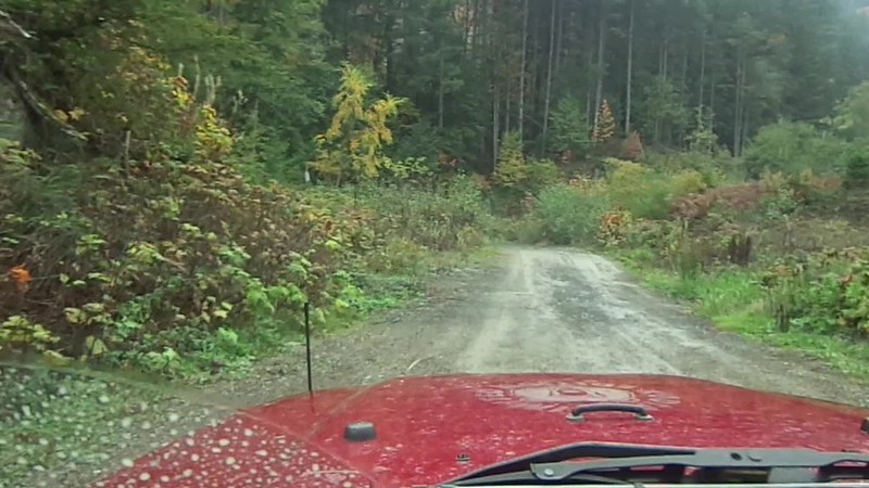
As I was only headed as far as mile 4 there was no rush to get there, or anywhere, so I puttered along content to check out small little goat trails off the main road that led to 2-3 truck camping spots or dead ended a couple of hundred feet off the FSR.


I took one of the main turn offs that gave a commanding few of the south end of Harrison Lake and snapped off a few pictures. Low hanging clouds associated with rain showers meant the lake was partly obscured for the camera but I could see just fine.The lake is 60 kms long so although I could see up and down the lake in reality I could only see a small portion of the lake.


This is one of my favourite pictures...I think it's due to the ribbon of brown sandwiched between greens and browns of the foliage with the vast blue and whites of vast lake in the background.

MAH01327

Proving that any age is a good age to splash in puddles, I decided to try out the video setting on my camera to see how it works. To do that I needed any "action" shot, and since the Jeep was still way too clean, I thought I could make everyone happy (me and the Jeep) at the same time.


There, that looks a lot better! Now all the other Jeep owners won't laugh at me and not let me play their stupid reindeer games!


Back down at the start of the forest service road is Weaver Creek Spawning Channels created by Fisheries Canada and now run by the local Sto:lo First Nations people.
The channels provide a natural habitat for the various types of salmon returning to spawn, the most prized being the Sockeye salmon.


Today it was mostly Chums in the hatchery beds but the limited numbers was enough to provide interest for the tourists.


The few Sockeye that were here stood out in stark relief to the mottled grayness of the Chum.


There is plenty of room in the man made beds but one thing is for sure - all the salmon end up as food for the wildlife. Bears, raccoons, seagulls, and every other form of fur and fowl have a field day gorging on the plentiful bounty of the salmon runs.


It's no surprise that such a great supply of food during the winter salmon runs would attract Bald Eagles to the area.The large predators enjoy a a tightly packed area of rivers full of spawning salmon. Weaver Creek, Chehalis River, Harrison River, Fraser River, and many side channels and marshes of the Harrison River and the Fraser River supply enough salmon to make this area one of the top 3 wintering areas of the Bald Eagle on the Western Flyway. The Squamish River area is usually #1 spot, Haynes Alaska is #2, and the Chehalis Flats area of the Harrison River is #3.
A tourist industry has sprung up surrounding the December-January return of the eagles. Squamish has done this for years but in the past 3-4 years this part of the larger Fraser Valley has gotten organised and promotes various marketing campaigns to bring the Metro Vancouverites to the area.


Remnants of a former age are scattered throughout the local forests...some of the biggest stumps of Red Wood Cedars and Douglas Firs I have seen are in a local suburban Surrey park. I spotted this one a mile or so up the Chehalis FSR as there were two geocaches I wanted to nab. The notch you see in the tree stump was chopped there by loggers to insert a springboard. A Spring board was a long plank of wood with a pointed end they would insert into the notch they cut into the tree. The trees of yesteryear were first growth trees,and often stood a couple of hundred feet tall. The bases of the trees were massive and would take forever to chop three either with an axe or with a two man whip saw. The loggers "cheated" a little bit by starting the cut 10' feet up the tree were the tree trunk was thinner.


There are numerous artesian wells in the area some of which are on private property. In this case, the local land owner was tired of people trespassing on his land to fill their water jugs and making a mess of the forest undergrowth so he tapped into the well and ran a line down the hill to the forest road for the public to access the water there. To make it a bit interesting he built a small rock wall and put a statue of Buddha to offer good vibes in the area. There is an Earth geocache here (Earth cache means there is no actual cache, just a "virtual" to discover the area, and another actual cache across the road along a the banks of a small creek. In the old days you would call that a "two-fer"  :)


On the list of my "must sees" when ever I bring someone new to the area is the old Kilby Museum in Harrison Mills. Originally a train stop it became a small community onto it's own as the local loggers from the logging "shows" or forest operations, needed a place to stay so the train stop became a combination general store below and a small boarding house on the upper floor. It was also a distribution point for the farmers in Chilliwack across the Fraser River who would row across the river with their fruits and vegetables to catch the 4.00 PM train to take their produce into the vast market of Metro Vancouver.

Later with the rise of the auto-mobile gas pumps were added to service the area. OK, so your first question is...."why is there a board walk going up to the second floor"?

This area was prone to springtime flooding and it was quite common for the surrounding land to be under 6 feet of water for a few weeks. The basement of the store, which was actually ground level, was just bare dirt and other than a few tools and work benches was left empty as it was often under water with the freshet.

I sauntered out of the Harrison Mills, rambled east down the Lougheed Highway, and meandered into the back roads of Lake Errock. Lake Errock is actually an old oxbow of the Harrison River situated slightly upstream of where it empties into the Fraser River. Looking at a topo map it's easy to see that this oxbow was probably part of the Fraser River at one time before the river cut itself off and left the Harrison River to claim this twixt of water.


Here was one of the neat things about aimlessly driving down back roads...you find the most interesting things. I knew that the Western Painted Turtle is on the endangered species list in BC. I have even seen them in some suburban parks sunning themselves on logs...I did not know there was a small population in a marshy area in the Fraser Valley. I have to chalk up this find to geocaching as there was a couple of nearby caches that highlighted this turtle oasis; without the impetus to drive down this stretch of road I might not have found this reserve.


All kinds of treasures are found are found down back roads...some are a wonder of nature, some are a small feat of modern man. In this case an old Fargo pickup truck trying to maintain it's dignity sat in a corner of someones rural property...all but abandoned and being overtaken by brambles. I can't help but think this is a diamond just waiting for the right person to find it and restore the truck to it's former glory.


Now this is what back road exploring is all about....a beauty of nature in the form of two large firs growing out of the same trunk tucked right against the edge of the road and the local community having the grace to leave the tree as is and have the road skirt the edge of the tree. This quaint image is one that I think of when I think of what I would like to see when I am Out and About rambling the back roads of Beautiful British Columbia.

The full album of today's pictures can be seen on my Flickr web page here.